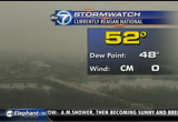
bob ryan just tweeted that is exactly average for this time of year. so, that was average. you can see a little bit of action here on the radar screen, i am blue, -- in a blue, green and yellow. we will get the worst out of the system the next couple of days. there is a warming saturday. then we will briefly cool again on sunday, just to spite again in temperatures on monday. -- just to spike again in temperatures on monday. we did a little bit of list in our atmosphere. that is what happens at the beginning of the warming trends. that could trigger an isolated sprinkle or two. our futurecast does pick up on this. montgomery county, frederick county, closer to the mason- dixon line. here is your forecast. 45 is the high temperature. quickly sliding down 330's. -- sliding down to be 30's. i think we will be in the 30's, just above freezing. warmer than yesterday's. we may have of you out morning sprinkles northwest of washington. otherwise, a dry day near 50. that is average. noticed the bumpy day temperature-wise. we will get shot down into the 40's. >> why can that not be
 Live Music Archive
 Librivox Free Audio
 Metropolitan Museum
 Cleveland Museum of Art
 Internet Arcade
 Console Living Room
 Books to Borrow
 Open Library
 TV News
 Understanding 9/11